Still commenting on the above article, I had some word on the map.
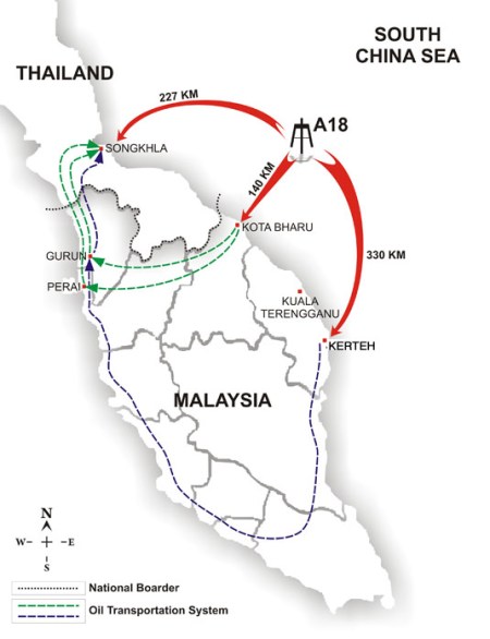
First thing I would like to point out is that the author says the green and blue line represents an oil transportation system.
At the moment, peninsular Malaysia has no oil transportation system. And there are no plans to have a consumer level transportation system (i.e. from refinery to distribution centre, to being piped into petrol stations and the like).
The blue line going from Kota Bharu to Gurun is possibly referring to the Trans-Peninsular Pipeline, which is getting a lot of press release last month (April, 2008). The pipeline will be used to transport crude from Yan to KB, with the intent of saving the travel time to send crude carriers around the Malaysian Peninsular via the Malacca Straits.
You can read articles on the commercial feasibility of the pipeline here and here.


 Posted by Wata
